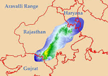
Aravalli Range:
-
Location:
-
They stretch for a distance of about 720 km from Himmatnagar in Gujarat to Delhi, spanning Haryana, Rajasthan, Gujarat, and Delhi.
-
-
Formation:
-
The Aravallis date back to millions of years when a pre-Indian subcontinent collided with the mainland Eurasian Plate.
-
-
Age:
-
Carbon dating has shown that copper and other metals mined in the ranges date back to at least the 5th century BC.
-
-
Characteristics:
-
The Aravallis of Northwestern India, one of the oldest fold mountains of the world, now form residual mountains with an elevation of 300m to 900m.
-
-
Guru Shikhar Peak on Mount Abu is the highest peak in the Aravalli Range (1,722 m).
-
It has been formed primarily of folded crust, when two convergent plates move towards each other by the process called orogenic movement.
-
Extension:
-
The mountains are divided into two main ranges – the Sambhar Sirohi Range and the Sambhar Khetri Range in Rajasthan, where their extension is about 560 km.
-
The hidden limb of the Aravallis that extends from Delhi to Haridwar creates a divide between the drainage of rivers of the Ganga and the Indus.
-
Their Significance:
-
Checks Desertification:
-
The Aravallis act as a barrier between the fertile plains in the east and the sandy desert in the west.
-
Historically, it is said that the Aravalli range checked the spread of the Thar desert towards the Indo-Gangetic plains, serving as a catchment of rivers and plains.
-
-
Rich in Biodiversity:
-
Provides habitat to 300 native plant species, 120 bird species and many exclusive animals like the jackal and mongoose.
-
-
Impacts Climate:
-
Aravallis have an impact upon the climate of northwest India and beyond.
-
During monsoons, it provides a barrier and monsoon clouds move eastwards towards Shimla and Nainital, thus helping nurture the sub-Himalayan rivers and feeding the north Indian plains.
-
In the winter months, it protects the fertile alluvial river valleys from the cold westerly winds from Central Asia.
-
-
Recharges Groundwater:
-
Aravallis also functions as a groundwater recharge zone for the regions around that absorb rainwater and revive the groundwater level.
-
-
Checks Pollution:
-
This range is considered the “lungs” for the polluted air of Delhi–National Capital Region (NCR).
-
For Haryana, having the lowest forest cover at around 3.59% of the total forest cover in India, the Aravalli range is the only saving grace, providing the major portion of its forest cover (2017 Report).
-
Threats:
-
The Aravalli hills are an ecologically sensitive zone but have for years borne the brunt of quarrying and environmental degradation.
-
A 2018 report by a Supreme Court-appointed Central Empowered Committee (CEC) found out that 25% of the Aravalli range has been lost due to illegal mining in Rajasthan since 1967-68.
-
The consequences of the mining has been a destruction of aquifers and deforestation. Many rivers originating in the Aravalli like Banas, Luni, Sahibi and Sakhi, are now dead.
Steps Taken:
-
Mining in the Aravalli region has been banned since 2002 under the Supreme Court orders, unless expressly permitted by the Union Environment Ministry. However, mining continues illegally.
-
The green wall is being planned from Porbandar to Panipat which will help in restoring degraded land through afforestation along the Aravali hill range.
-
Residents along with volunteers from iamgurgaon, a citizen action group involved in the conservation of the Aravallis, were assisted by ecologists to create a self-sustaining Aravalli. This society driven model could be more effective to combat the degradation.