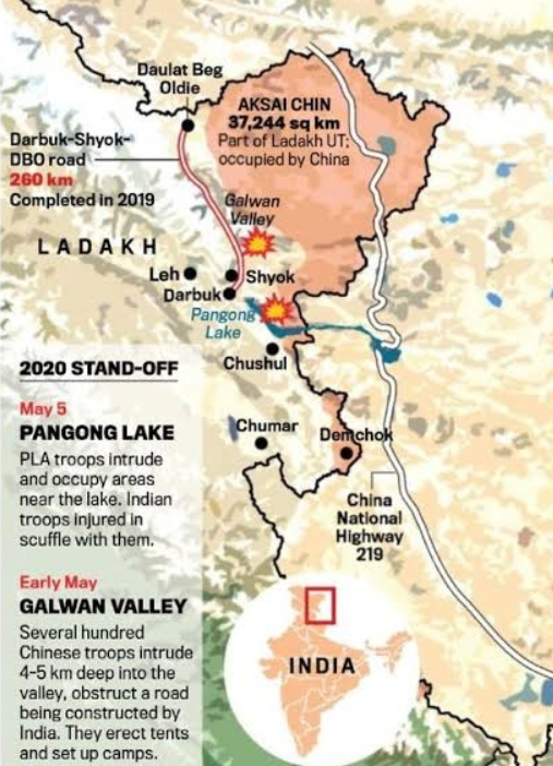
Demchok Sector:
-
Demchok sector is a disputed region situated near the confluence of the Charding Nullah and Indus River.
-
It is part of the greater Sino-Indian border dispute between China and India.
-
Both India and China claim the disputed region, with a Line of Actual Control between the two nations situated along the Charding Nullah.
-
The Charding Nullah was mentioned by the name “Lhari stream” in a treaty between the Kingdom of Ladakh and the Ganden Phodrang government of Tibet in 1684 and stated as the boundary between the two regions.
-
British surveys placed the border in 1847 between the princely state of Jammu and Kashmir and Qing Tibet on the stream, while British maps from 1868 onwards placed the border downstream and west of Demchok.
-
After independence in 1947, India claimed the southern watershed of the river (roughly 3 miles southeast of Demchok) as its boundary, which has been contested by the People’s Republic of China whose claims coincide with the British maps.
-
The two countries fought a brief war in 1962, after which the Demchok region has remained divided between the two nations across a Line of Actual Control.