HySIS
- It is an Earth Observation Satellite by ISRO
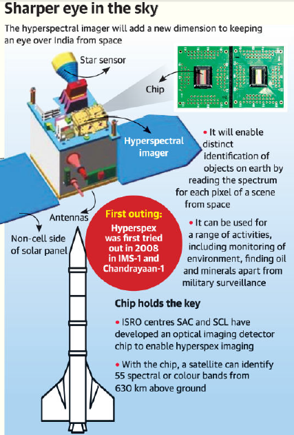
- The HySIS satellite has critical chip called an “optical imaging detector array’” indigenously developed by ISRO.
- Its launch will allow ISRO to enter the domain of operational hyperspectral imaging from earth orbit.
- HySIS satellite developed by ISRO can see in 55 spectral or colour bands from 630 km above ground.
- It can be used for a range of applications from monitoring the environment, crops, looking for oil and minerals, military surveillance.
Hyperspectral Imaging
- Hyperspectral imaging or hyspex imaging (imaging spectroscopy) combines the power of digital imaging and spectroscopy.
- It collects and processes information from across the electromagnetic spectrum.
- Hyspex imaging enables distinct identification of objects, materials or processes on Earth by reading the spectrum for each pixel of a scene from space.
- The hyspex technology is still an evolving science.
- It has ability to add a new dimension to plain-vanilla optical imagers.